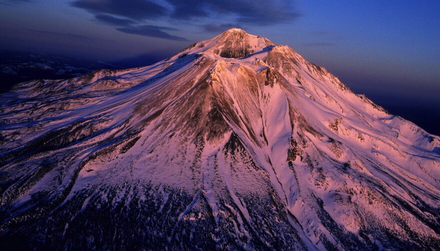
“Lonely as God and white as a winter moon.” That’s how 19th-century poet and Pony Express rider Joaquin Miller described Mount Shasta, California’s most majestic and mysterious mountain.
The state’s fifth-highest peak but more impressive than any other, Shasta is clearly visible from as far away as 150 miles. Camp or picnic—or just sit and stare—somewhere you can commune with the mountain. (It’s not safe to drive while looking.) Up close, though, Shasta is more obscure, harder to grasp.
Native people revere Shasta as the abode of the Great Spirit. Others, too, attribute special power to the great mountain. Buddhists, Tibetan shamans, Christians of all stripes.
French mountaineer René Daumal, author of the unfinished 1952 cult classic Mount Analogue: A Novel of Symbolically Authentic Non-Euclidian Adventures in Mountain Climbing, chronicles the great mountain climb to God. He also somehow describes Shasta:
In the mythic tradition the Mountain is the bond between Earth and Sky. Its solitary summit reaches the sphere of eternity, and its base spreads out in manifold foothills into the world of mortals. It is the way by which man can raise himself to the divine and by which the divine can reveal itself to man.
But Daumal’s spirit mountain must also exist, physically, not just in allegory:
Its summit must be inaccessible, but its base accessible to human beings as nature made them. It must be unique and it must exist geographically. The door to the invisible must be visible.

A National Natural Landmark in the midst of Shasta-Trinity National Forest, Mount Shasta is certainly visible. It’s the highest point in California’s Cascades, and the largest volcano in the contiguous 48 states. Mount Whitney is taller by 332 feet, and other mountains are bigger by other measurements, but their grandeur is lost among other lofty peaks. Not so Shasta, which stands alone at 14,162 feet and towers almost 10,000 feet above the surrounding countryside. Lonely as God, white as a winter moon.
There is always snow on Shasta—or at least, so far, in our reckless climate change experiment. Hikers and backpackers walk up into it via forest trails from spring to early September, but only the fit and fairly determined get to the top. The truly intrepid tackle technical climbs, almost any time.
A Yreka merchant, E.D. Pearce, is credited with the first ascent of Mount Shasta, though we can safely assume that Native Americans visited the mountain regularly, for religious ritual and other purposes, for thousands of years previous. Scientists first braved the mountain in 1862, when Josiah Whitney led a Geological Survey party to the summit. When they got to the top, they found tin cans, broken bottles, a Methodist hymnbook, a newspaper, a pack of cards, and “other evidences of bygone civilization.”
Non-climbers—at least those who aren’t climbing literally—take the highway up the mountain anyway, to where the road ends. Once the smoke clears, from there, 8,000 feet up, you can see the entire north end of the Sacramento Valley, Burney Falls, Lassen Park, the Trinity Alps, Castle Crags, the Sacramento River Canyon, and Lake Siskiyou below. Wow.
Up the Road Encourages Responsible, Safe Travel
Here are previous Up the Road episodes that explore why we should travel, how to do it responsibly, and how to travel responsibly now, in the shadow of COVID-19. Not everyone should be traveling now, of course, depending on your likely vulnerability to the deadliest effects of this new virus. But everyone who does travel needs to do so responsibly, to prevent viral spread.


